Welcome to the future
of underground
cable mapping
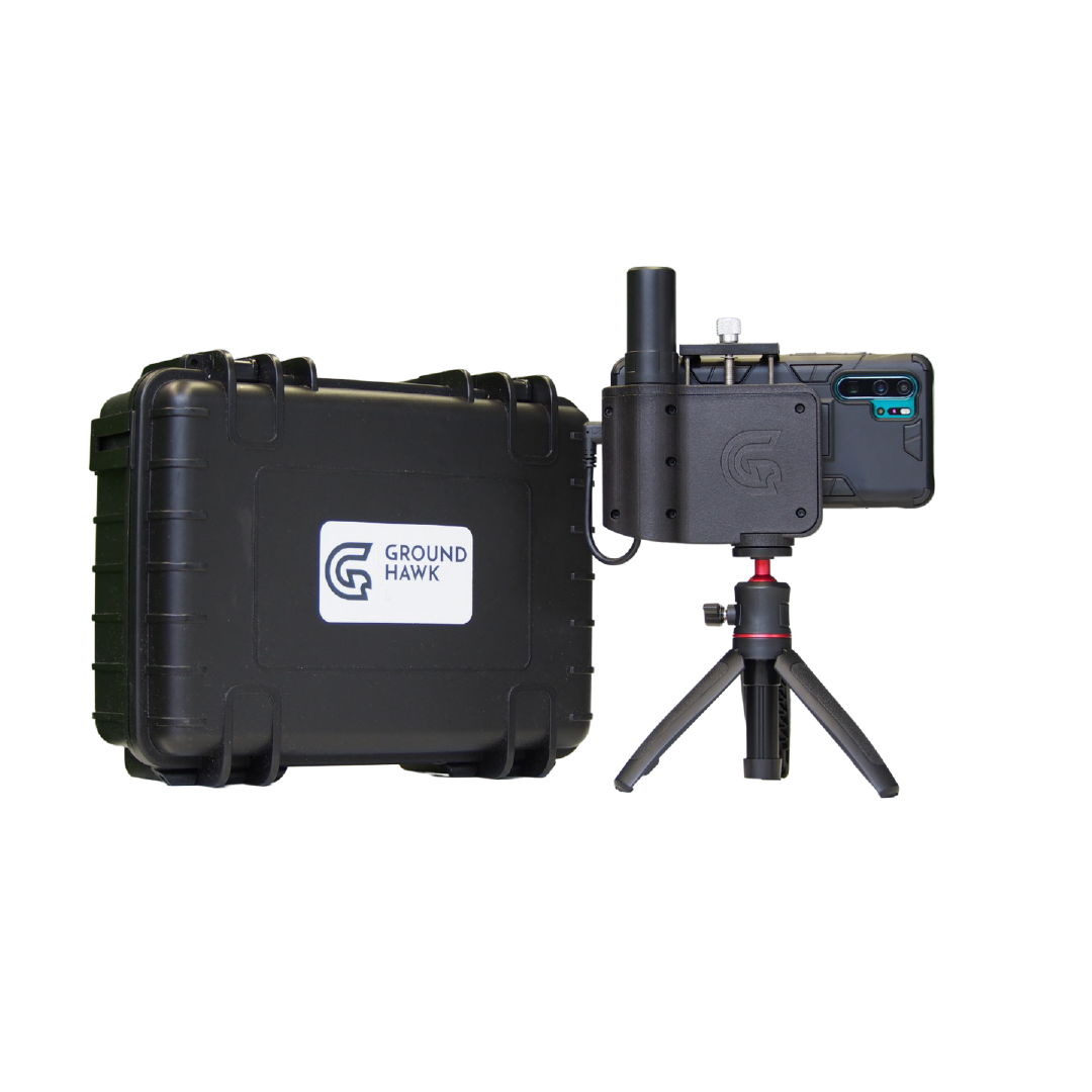
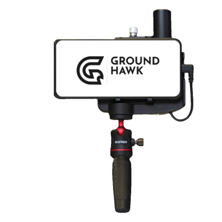
Groundhawk makes underground cable mapping easy. Using the device does not require previous mapping skills. With Groundhawk your contractors who are already on-site can perform the mapping. Real-time as-built documentation is now a reality.
Groundhawk solves common challenges
familiar to all cable contractors
Challenges with underground cable mapping? You are not alone. Based on surveys and discussions with cable contractors in different countries these challenges listed underneath are familiar to all cable contractors. With Groundhawk you are able to solve them all in an instant.
Depth mapping needed
- Precise cable depth mapping also required by customer or regulation
- Post measurement with GPS stick and cable detector often fails in accuracy
- A mapping expert is too expensive to have on site all the time
Poor documentation
- Lack of photos and measurements to prove depth or installation according to spec
- Difficult to find the documentation captured during construction
- Paper documents getting lost - takes time to find them or notes are inaccurate
Substandard construction
- Hard to ensure that the building phase is done correctly in the first place
- Documenting the quality is not easy but important to reduce need for quality control and resolve controversies
Lack of visibility into project
- Challenging to ensure that project managers have clear and real-time view on their projects
- A lot of manual reporting on progress to customer and management to be done in every project
So, how to use Groundhawk?
Using Groundhawk is easy. Let us show you how it's done.
Why open trench mapping?
Open trench mapping is a more and more popular mapping method among contractors. That is no surprise as it has many benefits versus the old way of mapping. Let us explain you why.
Future vs. the past
In the yellow boxes we have demonstrated the benefits of open trench mapping. In the grey boxes you can see how underground cable mapping was done in earlier days.
With Groundhawk you are ready to step into the future of underground cable mapping and documentation.
Mapping approach
During construction
Mapping and documents are done when trench is open. This saves time and money on the later phase of construction.
Mapping approach
After
construction
Buried cables are located afterwards. Sometimes finding them is difficult.
User
On-site
builder
Solution is fast and easy to use by anyone on-site. Short training ensures the quality of mapping work.
User
Professional surveyor
Surveyor needs to travel to the site.
This all takes patience, time and money.
Mapping technology
Precise
3D scanner
Open trench mapping is done by using 3D scanner. Accurate depth. Network elements and photos for documentation in digital format.
Mapping technology
GPS stick +
cable scanner
Map exact points with GPS stick every 10m. Depth is an estimation.
Construction quality
Transparency
Construction quality is transparent due to lots of photos and 3D measurements.
Construction quality
Hard to validate
Underground cable depth, cable protections, connection points etc. are not visible afterwards.
Collected data
Automatic
3D scanned trench, network element data and photos automatically taken and send.
Collected data
Manual
Depth and GPS points entered manually to the system. Errors are common.
Site data handling
Online
Automatically processed NIS ready data as collected from the field. Geotagged photos produced for quality documentation.
Site data handling
Offline
GPS points referenced with network element data in GIS software and combined with paper notes, photos from whatsapp… All done manually.
Groundhawk in a nutshell
Discover how using Groundhawk changes underground cable mapping and documentation - download the brochure to find out how you can get ahead of competition.
.png?width=1414&height=2000&name=Groundhawk%20(2).png)
How does modern 3D mapping improve cable surveys?
Modern 3D mapping, often using technologies like photogrammetry and LiDAR, creates highly detailed and accurate digital twins of the survey area. Unlike traditional methods that might only provide 2D line drawings or sparse data points, this gives you a complete, measurable 3D model. For cable surveys, this means you can precisely identify the cable's location, measure its depth, detect potential hazards like bends or obstructions, and plan maintenance or new installations with much greater confidence and accuracy. This significantly reduces the risk of costly cable strikes and project delays.
Who is the ideal user for the Groundhawk system?
Groundhawk is designed to be user-friendly so that it can be operated by the on-site construction and contractor teams who are already installing the cables. It does not require a dedicated surveyor or mapping expert. This makes it ideal for:- Infrastructure Contractors: Companies building out fiber optic (FTTH/B) and electrical networks who need to provide accurate as-built documentation to network owners.
- Network Owners: Utility and telecommunication companies who require high-quality, reliable data on their underground assets to ensure network resilience and simplify future maintenance.
- Project Managers: Individuals overseeing large-scale infrastructure projects who need real-time visibility into construction progress and quality control.
Cable Survey
Groundhawk streamlines cable surveys by providing accurate ground data and clear visualizations. This helps teams map existing infrastructure and plan new cable routes with confidence.
As-Built Documentation
Create precise as-built documentation in real time. Groundhawk captures underground layouts and ensures records are always up to date for compliance, maintenance, and future projects.
Fiber Trenching & Fiber Rollout
Simplify fiber trenching and rollout projects with Groundhawk’s reliable data. From initial planning to installation, it supports efficient fiber deployment while reducing costly errors.