Transforming the Traditional Cable Survey Process with 10cm Accuracy
A major challenge in any cable survey is achieving verifiable depth and location data. Post-measurement with a standard GPS stick and cable scanner often results in depth being an estimation, not an accurate measurement, which can fail regulatory or client requirements.
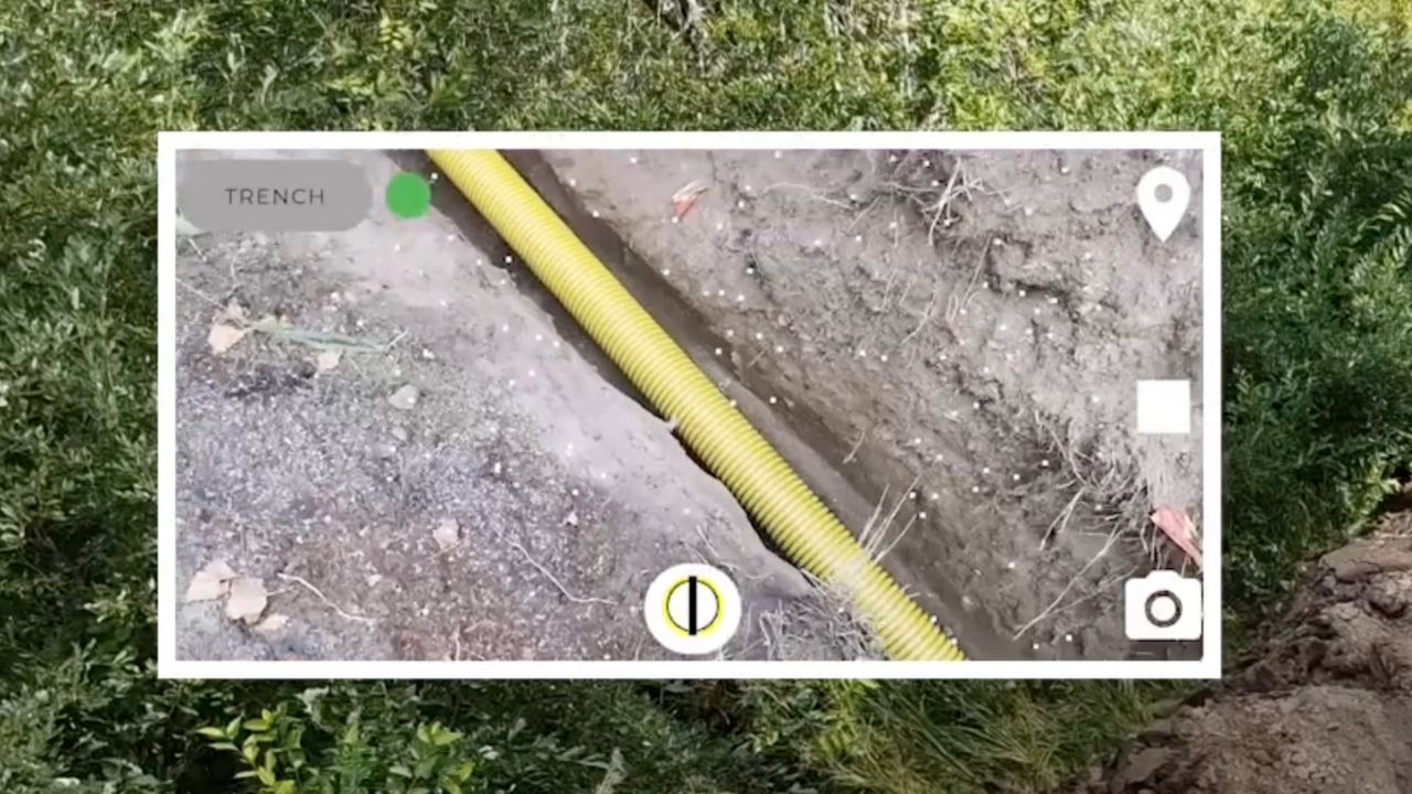
Groundhawk eliminates this risk. We use GNNS + RTK based satellite navigation paired with advanced stereo vision to 3D scan the open trench in seconds. This powerful combination allows us to capture accurate location measurements for every cable and protection element in X, Y, and Z (m above sea level), and relative depth D (cm from ground level). This is 10 cm accuracy in all dimensions, solving the precision problem inherent in any professional cable survey.
Real-Time, Automated Documentation for Every Underground Cable Survey
Why rely on a professional surveyor who must travel to the site when the solution can be used by anyone already on the job? Groundhawk makes the entire cable survey process fast and accessible. Using the device is easy and does not require previous mapping skills, saving your team time and money.
The secret lies in the AI. Our advanced AI and 3D modelling automatically derive the exact cable location and depth from the scan data—meaning no manual processing is needed. The result is real-time as-built documentation complete with geo-tagged photos and NIS-ready data that is automatically sent online. This transparency makes it easy to guarantee construction quality, reduce the need for on-site quality checks, and ensure every element of the underground cable survey is documented to the highest standard.