”Industry estimates suggest inaccurate or outdated records of underground cables and pipes contribute to more than €100bn in damage globally each year, alongside delays and safety risks."
”A Finnish infrastructure software technology company transforms how underground utilities are mapped and documented.”
”The company’s technology combines high-precision satellite positioning, 3D scanning, and AI analytics.”
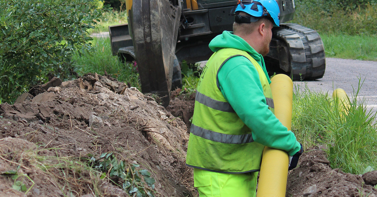
”Unlike traditional surveying methods that require specialised personnel and separate site visits, Groundhawk is designed for ease of use directly within existing construction teams."
”Groundhawk enables crews and project managers to verify that cables, ducts, and connection points are installed correctly before the site is closed.”
”Beyond cost savings, Groundhawk’s technology delivers measurable environmental benefits."
”Groundhawk is addressing the more than 20% efficiency waste that currently impacts infrastructure construction.”
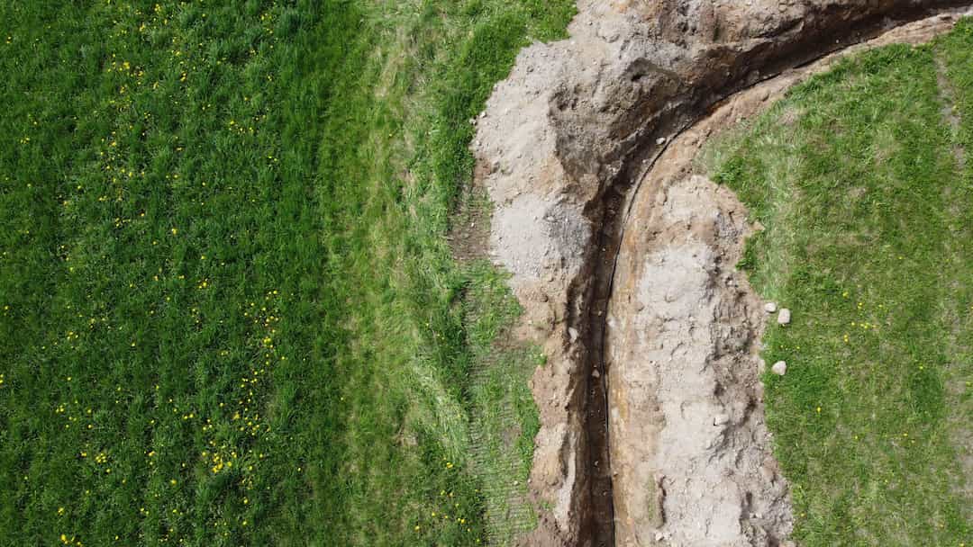
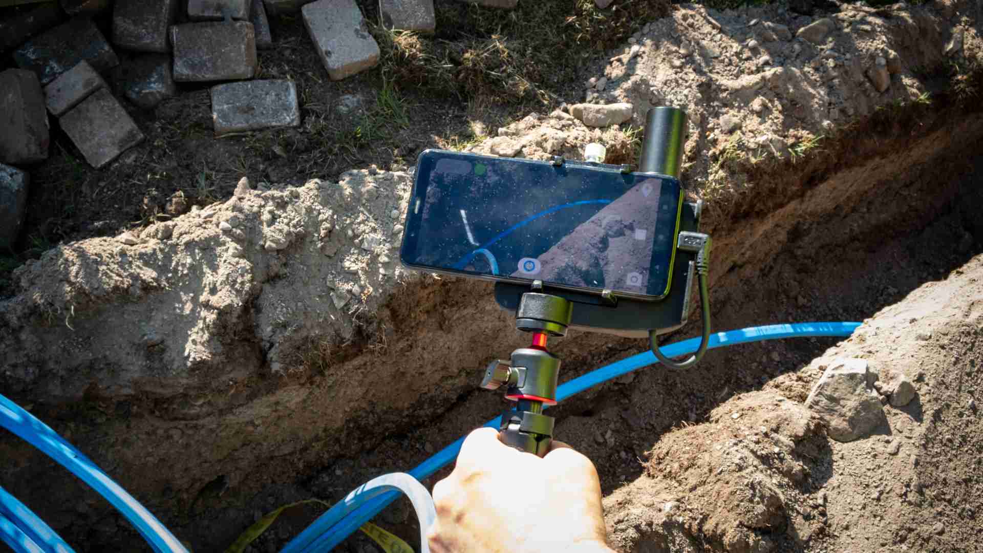
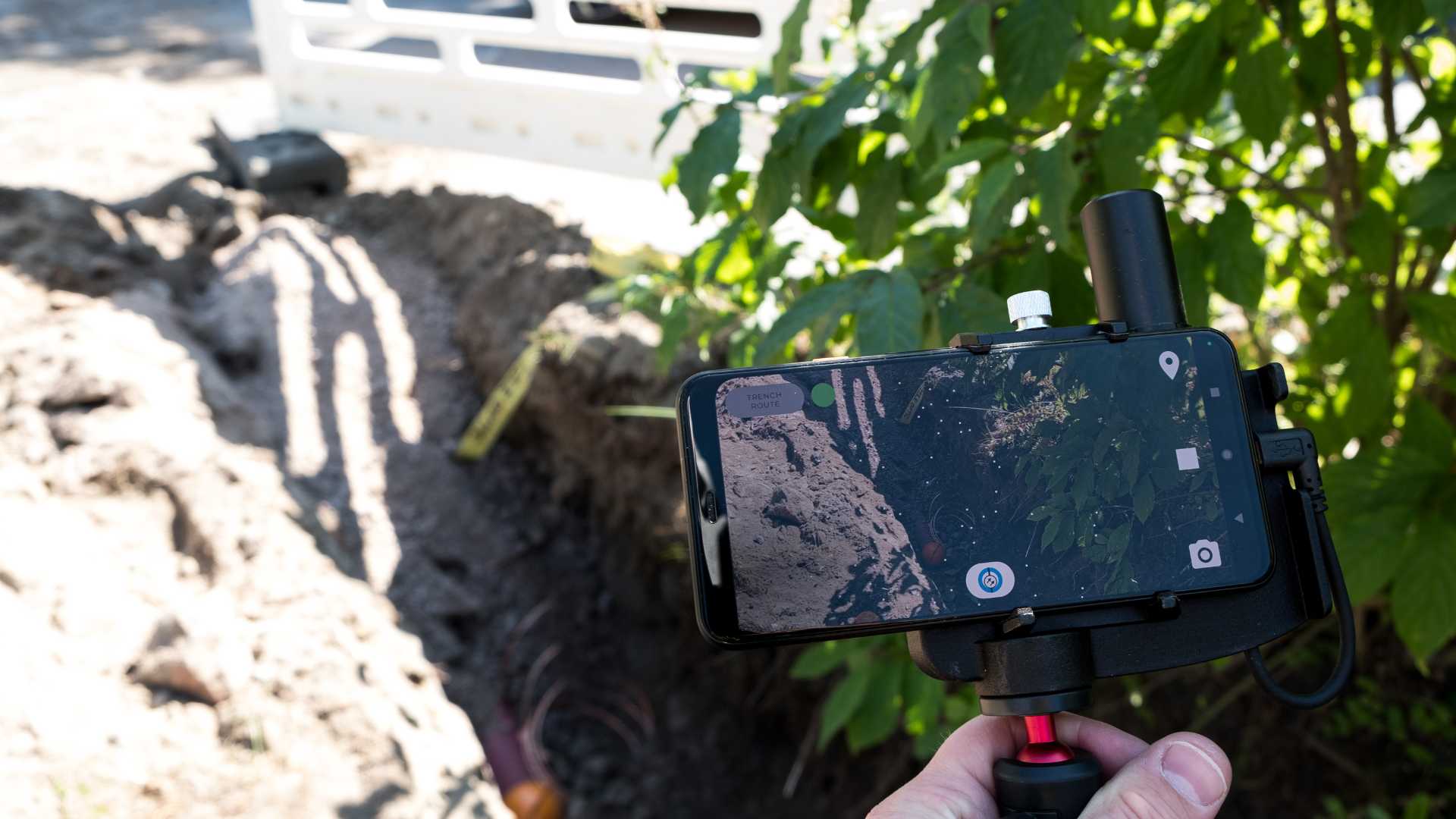
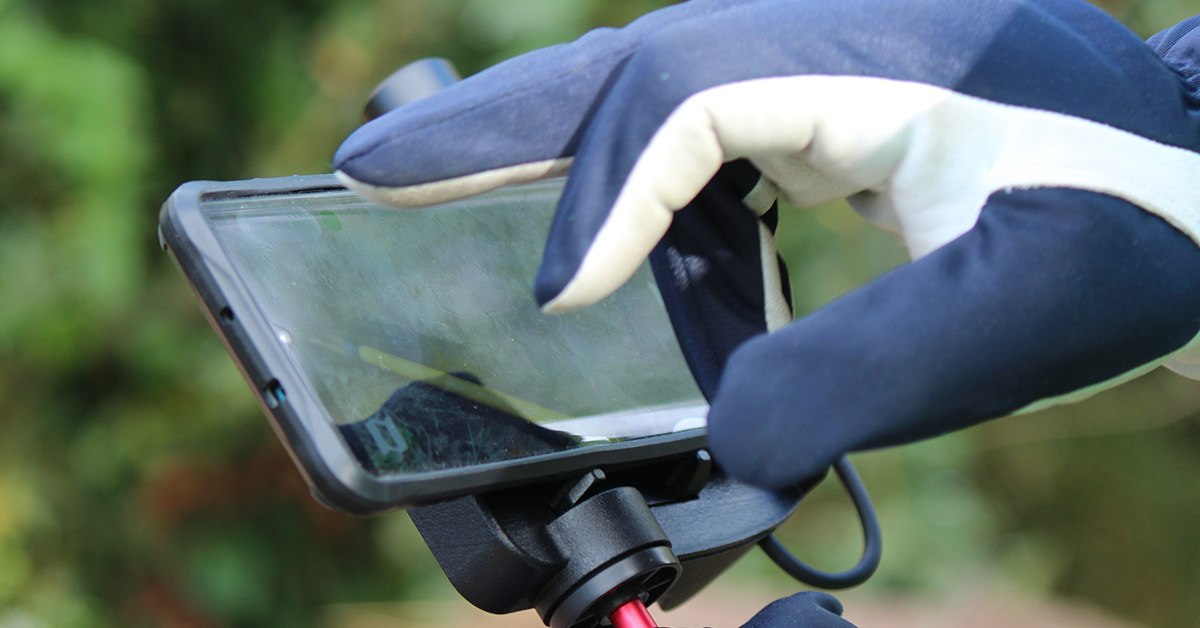
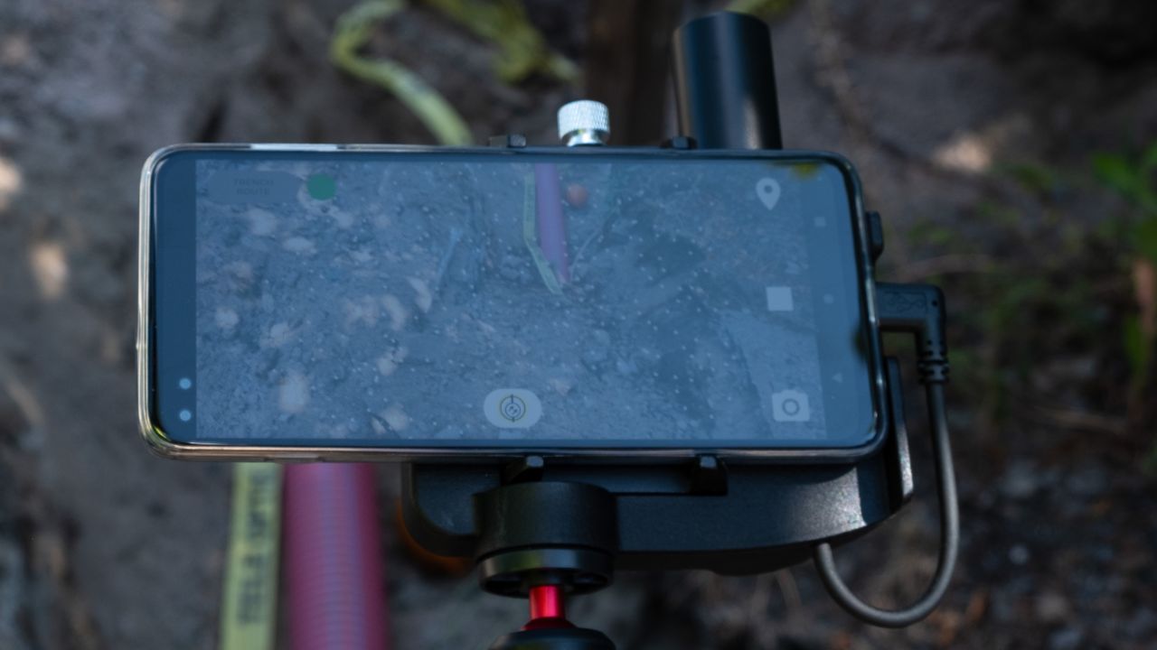
”All data synchronises in real time to a cloud platform, giving network owners precise visibility and an accurate map of their entire new underground network."
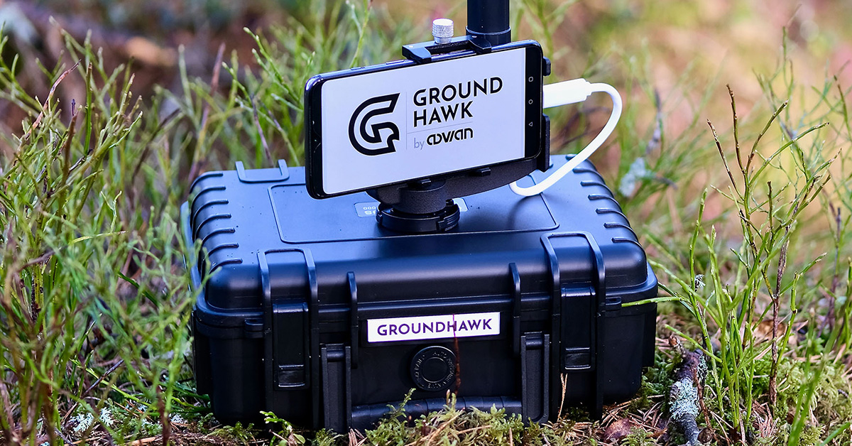
”The system enables construction teams to digitise underground cables and grids with centimetre-level accuracy while trenches are open."
”Instead of passive documentation produced after a project is completed, Groundhawk turns mapping into an active quality-assurance process, helping teams detect and correct errors immediately."


.jpg?width=400&height=150&name=Linkedin%20post%20Telepatrol%20GROUNDHAWK%20(2).jpg)
.jpg?width=1200&height=1200&name=Linkedin%20post%20Telepatrol%20GROUNDHAWK%20(2).jpg)


.jpg?width=317&height=317&name=Linkedin%20post%20Telepatrol%20GROUNDHAWK%20(5).jpg)

.jpg?width=317&height=317&name=Linkedin%20post%20Telepatrol%20GROUNDHAWK%20(3).jpg)


.png?width=100&height=100&name=Media%20hits%20Groundhawk%20(1).png)

.jpg)