Street Lighting, Traffic Systems, and Public-Space Cabling

Document both the linear cable network and individual lighting assets

The network may share trenches with other municipal infrastructure. Each pole must typically be linked to the correct cable route, circuit, cabinet, and asset identifier.

Groundhawk lets the construction team document both the linear cable network and individual lighting assets.

See the planned route and the property borders

Find the planned route and visualise it in Groundhawk. No paper map to carry or re-draw. Find cadastral property borders to avoid digging on the wrong property by mistake.

See what was actually installed

Groundhawk lets field teams document the installed network as construction progresses. Instead of relying on the planned alignment, the record carries the deviations, crossings, obstacles and changes made on site.

Every excavation is a chance to correct the record

Groundhawk supports not only new construction documentation, but the gradual improvement of legacy network information through maintenance and repair activity.

Challenge:
Three documentation problems

An FTTH/X (Fiber to the Home / Fiber to the X) network is a high-speed broadband communication system that uses fiber-optic cables to replace traditional copper wires for all or part of the "last mile" connection to end users.

Fiber construction covers three broad situations that share the same documentation problem: backbone routes between cities, exchanges, data centres, and mobile sites; fiber-to-the-home rollouts made up of large numbers of short connections; and dedicated business or industrial connections to offices, factories, hospitals, campuses, and data centres.

The physical network is largely the same in all three. It includes fiber cables, main ducts and sub-ducts, chambers, handholes, cabinets, splice locations, road crossings, building-entry points, façade sections, indoor terminations, and connection points to other networks.

A single project commonly combines several installation methods. Open trenching may be used along one section, plowing along a rural roadside, horizontal directional drilling beneath a road, impact moling beneath a driveway, and existing ducts within an urban area.

Work is usually divided between several contractors and crews operating at the same time, across long rural distances on backbone projects, across hundreds or thousands of addresses on access projects, and inside controlled private sites on business connections. The final record must still form one continuous and coherent dataset.

Deviations from plan are normal. Routes change because of landscaping, underground obstacles, property-owner requirements, existing ducts, dense industrial infrastructure, or a different building-entry point than the one designed.

The main documentation challenge is therefore consistency: recording the actual installed route and every significant asset the same way across long distances, high connection volumes, and changing construction conditions.

How Groundhawk supports mapping and documentation of Public-Space Cabling?

Public-space cabling projects may involve new roads, residential areas, parks, pedestrian routes, renovation of existing lighting, or replacement of individual poles and cables.

The network may share trenches with other municipal infrastructure. Each pole must typically be linked to the correct cable route, circuit, cabinet, and asset identifier.

With Groundhawk your team documents both the linear cable network and individual lighting assets.

The cable route can include cable type, depth, protection, circuit information, and connection to cabinets or joints. For example, a new residential street may contain thirty light poles connected through an underground cable loop.

Groundhawk can map the cable route, each pole, the cabinet, cable branches, and photographs of the foundations before covering. This creates a structured record that supports municipal acceptance and future maintenance.
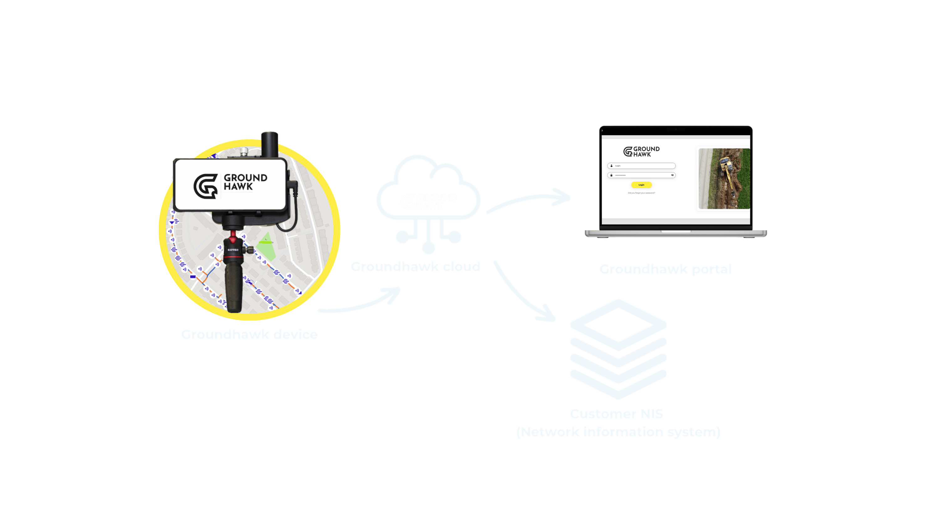
Groundhawk cloud


Plan, build and ensure quality

Ducts and cables

3D cable and duct routes with automated depth measurement
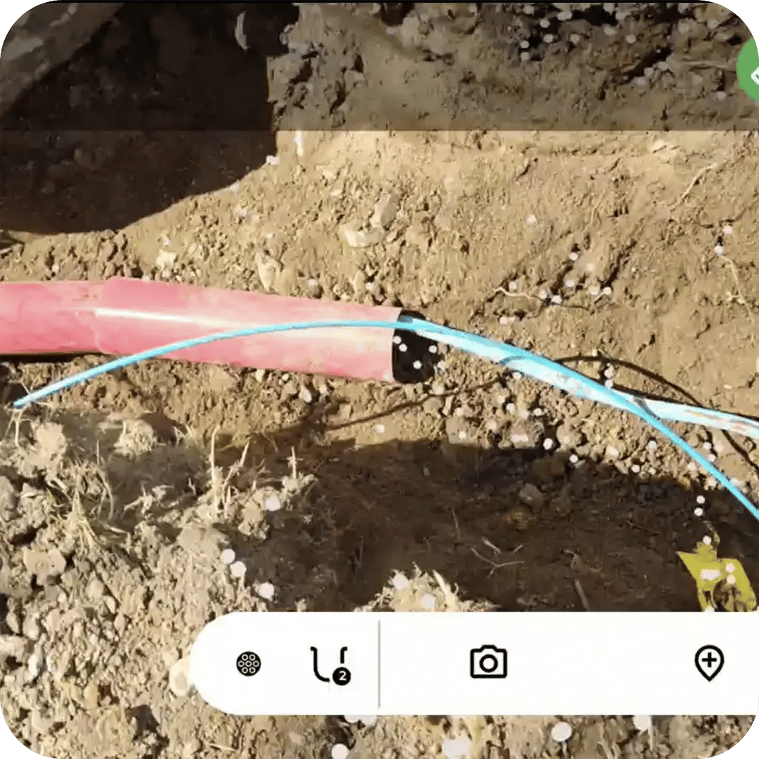
Geotagged photos Groundhawk


Points of Interest

Every cabinet, drop-off and connection point in 3D, with photo evidence
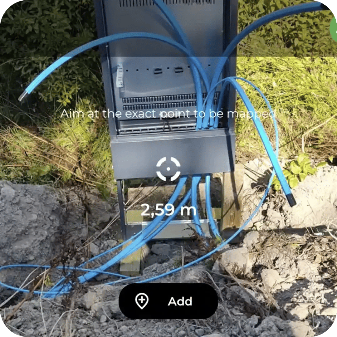
Point cabinet Groundhawk


Points of interest

Every cabinet, drop-off and connection point in 3D, with photo evidence

Cabinets, customer drop-offs and customer end points. Marker balls, connection points and any other point of interest. 3D position and photo evidence recorded together at the point.

”Strong recommendation from us.”​

”Easy to use.”

”Probably the most reliable mapping."​

”Mappings are always imported well into NIS.”​

”All network elements get more reliably documented."​

”Mappings and photos are available immediately.”​

”Finally mapping is not done based on paper markings or worse, based on memory."​

”With Groundhawk potential issues can be immediately addressed."​

”The contractor commented that they want to use it in the next work site as well."​

”All mappings worked first time and there was no need for retakes."​

Benefits

Direct cost

Accurate 3D mapping from the open trench, by the team already on site

No separate surveying visit to schedule, wait for or pay for. The mapping cost comes out of the work that is already happening.

One source

All data in one place
on the map

Easily exportable, or integrated into your own system through the API. Nothing is left in a phone gallery or a glovebox.

Quality assurance

Proof of work, on the map

What was done, when it was done and how it was done. Visible to the project manager and the network owner without a phone call.

Points of interest

Every cabinet, drop-off and connection point in 3D, with photo evidence

Cabinets, customer drop-offs and customer end points. Marker balls, connection points and any other point of interest. 3D position and photo evidence recorded together at the point.

Benefits

Direct cost

Accurate 3D mapping from the open trench, by the team already on site

No separate surveying visit to schedule, wait for or pay for. The mapping cost comes out of the work that is already happening.

One source

All data in one place
on the map

Easily exportable, or integrated into your own system through the API. Nothing is left in a phone gallery or a glovebox.

Quality assurance

Proof of work, on the map

What was done, when it was done and how it was done. Visible to the project manager and the network owner without a phone call.

How the cable mapping is done?


Use Case
White Paper

Walk through the installation techniques field teams actually use and see how Groundhawk captures accurate as-built data at each stage, regardless of construction method.

Street Lighting, Traffic Systems, and Public-Space Cabling

Extending the network to new customers stops being guesswork

Knowing what is in the ground removes the need for test digging. No new ducts installed where spare capacity already exists. Picking up a drop-off point is easy when you know exactly where it was left. Hours saved per connection.

Book a online demo session with us and you'll discover how leading contractors across the Europe are transforming their approach to surveying and documentation using real-time 3D scanning technology – saving time, cutting costs, and protecting underground assets.