
Leading contractor companies are always looking for ways to streamline processes, reduce costs, and increase productivity.
But, isn’t mapping and documentation just a necessary cost of doing business when building underground cables? You have to do it, but as long as you tick the box, follow the requirements, it doesn’t influence the business? WRONG!
Implementing good mapping and documentation practices and using modern tools can help the business in several important ways: increase build quality, reduce quality costs, make project management more efficient, ease documentation work, complete projects and invoicing faster and make the workplace safer.
Modern cable mapping approach brings value for the business
Let’s compare the old way of working for many prime contractors with a modern real-time mapping approach.
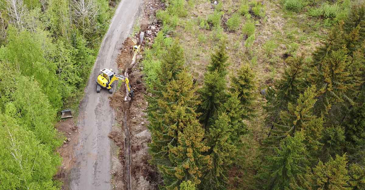
The old way of doing cable mapping is typically that cable trench is dug and immediately filled up and weeks later someone comes with a GPS device and cable scanner, locates the cable and takes a point every 5-10 m to indicate a cable between these points. Data that later becomes available is sparse points, typically lacking depths and no geotagged open trench photos.
The modern approach to cable mapping is that the building team also maps and documents the open trench in 3D and with geotagged photos while digging. The data from the field is available to project management and other stakeholders in realtime. Data: High-quality XYZ data for every meter, photos and trench data available in realtime.
So why is the modern cable mapping approach good for business?
- Achieve the accurate mapping requirements affordably. By enabling the construction team already at site to map while they are working, you get the benefits of open trench accurate 3D mapping. Imagine the difference of a 3D scan every meter of an open trench with photos showing connection points, protection pipes etc. You avoid having extra people mapping afterwards from a closed trench, inaccurately. There is no need for a mapping person searching for the cables weeks afterwards with a cable scanner and making a point every 10m.
- Less quality costs. When the building team knows the cabling trench is 3D scanned and well documented with photos, hiding problems out of sight isn’t an option anymore. Also suspected quality problems can be checked from data and documentation without expensive field surveys.
- Efficient project management. Photos and building progress is up to date instantly for the project manager to follow. Fewer site visits and less traveling is needed to get a sense of what is going on in the field. Also feedback to the team can be provided remotely based on photos captured of critical spots.
- Easier documentation. The process of documentation is streamlined and augmented. The documenter gets the right mapping file formats and codes and can compare with images on the map if there are any questions. For larger projects the documentation can be completed during the project in parallel with construction. This ensures that documentation gets the right information from the worksite.
- Finish project and invoice faster. As mapping is done during the construction and documentation can take place in parallel, so the handover of the project and invoicing are completed faster. This benefits everyone in the value chain.
- Safer workplace. Good mapping accuracy ensures well known positioning of the electricity cabling. This way, your employees are better prepared to avoid costly and dangerous accidents.
- Competitive advantage. When bidding for new projects, having a high quality approach to mapping, documentation and project management can be what sets you apart from competition and makes you win the deal.
For network owners the benefits of contractors using a modern mapping solution are obvious – well mapped and documented network 1) have less accidental cuts and a decreased need for urgent repairs of broken cables, 2) is easier and faster to fix when location of potential weak spots are known and documented with photos, 3) participating during construction is easier due to good transparency of the project, and 4) the value of a well documented network is higher.
The field workers benefit from a modern mapping solution as well. Less tedious paper maps and documentation at the site, no need for physical markings for mapping persons, geotagged photos providing proof that "they didn't break it, it was already", and less reporting as project management is following in real-time what is being built at the worksite.
So, after all this being said, it is no surprise that prime contractors are paying attention to what approach to mapping they are taking as it directly links to their business. Mapping done right can bring efficiency and new revenues. That's why Groundhawk, is found in leading contractors’ tool kits. If you would like to pilot the solution in your company, please don't hesitate to contact us!
Comments